 Continuing from Part 1, at https://gothamhistory.com/2015/06/08/street-names-changed-or-now-obsolete/. So many tales lurk herein, but let’s focus briefly on Tin Pan Alley, a neighborhood centered on West 28th Street between Fifth and Sixth Avenues. Known for the large collection of songwriters and publishers who congregated in the area, as Don Jensen has written in “A Base Ball Krank’s Guide to Madison Square” (Base Ball: A Journal of the Early Game, 2014):
[Tin Pan Alley] dominated popular music in the United States from the 1890s to the 1920s. (The name may have derived from a reference by Harry Von Tilzer in the New York Herald to the sound made by the thin, tinny tone quality of the cheap pianos [offered] in music publishers’ offices.) …. George Gershwin, Jerome Kern, and Irving Berlin, along with many others, began their careers on the “Street of Songs.” But other kinds of businesses also practiced their trades there. In addition to Miss Flippeny’s, the building at 57 West 28th was a gambling den. For a time during the 1890s, Thomas Edison’s office for moving pictures was at No. 43, where he reportedly shot film on the roof. The New York Clipper, America’s first newspaper devoted to sports and entertainment, including baseball, had its offices at No. 47, not far from the William Morris Talent Agency (though the Clipper’s original offices were downtown).
Tin Pan Alley will be found on no map of New York City streets, but Tin Pot Alley, whose existence clearly was invoked by the music folk. Running from 59 Greenwich to 91 Trinity Place, it was the former name of Exchange Alley and was also known as Oyster Pasty Alley. This name was commonly applied to a locality on the shore of the North river, opposite the present Exchange Place. A fortification at the end of this small lane, leading from Broadway west (now a part of Exchange Place) was known as the “Pasty Mount.” Charles Hemstreet wrote, in Nooks and Crannies of Old New York (1899):
There is a rift in the walls between the tall buildings at No. 55 Broadway, near Rector Street, a cemented way that is neither alley nor street. It was a green lane before New Amsterdam became New York, and for a hundred years has been called Tin Pot Alley. With the growth of the city the little lane came near being crowded out, and the name, not being of proper dignity, would be forgotten but for a terra cotta tablet fixed in a building at its entrance. This was placed there by Rev. Morgan Dix, the pastor of Trinity Church.
Jensen observed that while Tin Pan Alley was always a place though never in one location, “a commemorative plaque is embedded on the sidewalk on East 29th Street just east of Broadway, where it is mostly unnoticed except perhaps for street vendors, pedestrians, and construction workers trying to restore the neighborhood to its former gritty charm.”
Jackson Avenue was the former name of University Place.
Jackson Place was an alley which ran north from No. 16 Downing St.; now called Downing Place.
Jauncey Lane was a country road which started between 93rd and 94th Sts., just west of West End Ave., and ran easterly crossing 8th Ave. at 94th St. and ending at the Eastern Post Road; about the present line of 96th St. between 5th and 6th Aves.
Jauncey Court was in the rear of Nos. 37, 39 and 41 Wall St. Jew’s Alley was the former name of South William St. Jew’s Alley was the former name of South William St. between Broad Street and Mill Lane.
Jew’s Alley formerly ran from Madison St. between Oliver and James Sts.
Jone’s Court was in the rear of Nos. 48. SO Wall St.
Jones Street was the former name of Great Jones St.
Judith Street was the former name of Grand St. between the Bowery and Center St.
King Street was the former name of Pine St. It was laid out about 1691 and was known as Queen St.; known in 1728 as King St.; name changed to Pine St. in 1793. King Street was the former name of William St. between Hanover Square and Wall St.
King George Street was the former name of William St. from Frankfort St. easterly to Pearl St.; known by this name in 1755.
Kingsbridge Road branched off from the Eastern Post Road a little north of McGowns Pass, about the present line of 108th St. between 5th and Lenox Aves., and ran northwesterly along the present St. Nicholas Ave. to 169th St., from there it followed along the present Broadway to the Harlem River, crossing the river on the old Kingsbridge.
Kingsbridge Road. There was a second road known by this name which started in the Village of Harlem; about the present Sylvian Place, between 3rd and Lexington Aves., 120th and 121st Sts., and ran northwesterly to 124th St. and Park Ave., then along 124th St. to the west line of Mount Morris Park, continuing northwesterly to 127th St. between Lenox and 7th Aves., then southwesterly to a point in the block bounded by Lenox and 7th Aves., 126th and 127th Sts.. then northwesterly to St. Nicholas Ave. between 131st and 132nd Sts., where it joined the other Kingsbridge Road. Kings Road was the former name of Pearl St. between Franklin Square and Park Row.
Kings Highway was one of the former names of Park Row and the Bowery.
Kip Street was the former name of Nassau St. between Maiden Lane and Spruce St.
 Kips Bay Street was a country road which started at the Eastern Post Road, the present Madison Ave. and 35th St. and ran southeasterly, crossing 2nd Ave. at 34th St. and ended at the East River at the foot of 34th St.
Knapp Place was formerly in the rear of No. 412 East 10th St. between Avenue C and Dry Dock Street.
Koninck Street was a former name of Pine St.
Lafayette Place was the former name of Lafayette Street, between Great Jones St. and 8th St. It was opened July 4, 1826.
Lamartine Place was the former name of West 29th St. Lamartine Place was the former name of West 29th St. between 8th and 9th Aves.
Lambert Street was the former name of Church St. between Edgar and Liberty Sts.
Laurens Street was the former name of West Broadway, between Canal and 4th Sts.
Leandert’s Place was formerly in the rear of No. 147 Seventh St., between Avenues A and B.
Leary Street was a former name of Cortlandt St.
Leather Street was the former name of Jacob St.
Lenox Place was the former name of 22nd St. between 8th and 9th Aves.
Leroy Place was the former name of Bleecker St. between Mercer and Greene Sts.
Leyden Place was the former name of Fourth Ave. between 11th and 13th Sts.
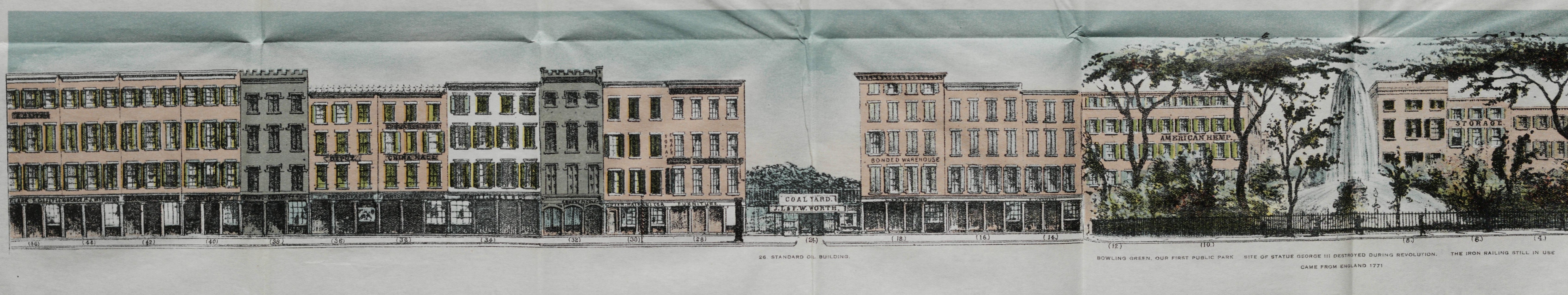
Broadway, both sides, from Battery Place to Tin Pot Alley (now Exchange Alley), in 1848, Valentine’s Manual
Liberty Court was formerly in the rear of Nos. 4 and 6 Liberty Place.
Little Street was the former name of Cedar St. between Broadway and the Hudson River.
Little Aim Street was the former name of Elm St. (now Lafayette St.) between Reade and Franklin Sts.
Little Chappel Street was the former name of College Place (now West Broadway) between Barclay and Warren Sts.
Little Division Street was the former name of Church St.
Little Division Street was the former name of Montgomery St.; known by this name in 1766-1767.
Little Dock Street was the former name of Water St. between Broad St. and Old Slip.
Little Dock Street was the former name of South St. between Whitehall St. and Old Slip.
Little George Street was the former name of Spruce St.; known by this name in 1725.
Little Greene St. was the former name of Liberty Place.
Little Queen Street was the former name of Cedar St. It was laid out about 1690 and was known as Smith St.; known in 1728 as Little Queen St.; known since 1793 as Cedar St.
Little Stone Street was the former name of Thames St.; known by this name in 1766; known since 1791 as Thames St.
Little Water Street was the former name of Mission Place.
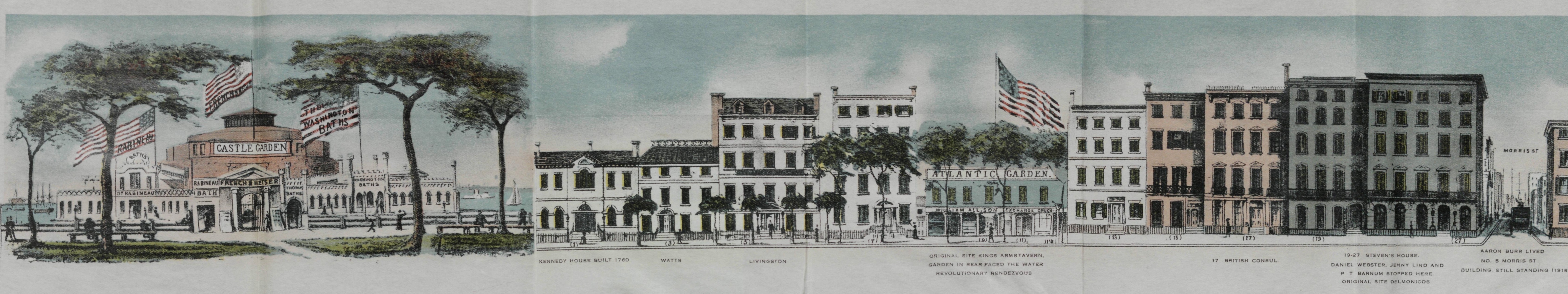
Broadway, both sides, from Battery Place to Tin Pot Alley (now Exchange Alley), in 1848, Valentine’s Manual
Locust Street was the former name of Sullivan St.
Lombard Street, Lombardy Street, were the former names of Monroe St.; known in 1791 as Rutgers St.; name changed to Monroe St. Jan. 10, 1831.
London Terrace was the former name of the north side of 23rd St. between 9th and 10th Aves.
Lorillard Place was the former name of Washington St. between Charles and Perry Sts.
Louisa Street. Kips Bay Farm was a country road which ran from the Eastern Post Road about the present Lexington Ave. and 32nd St. southeasterly, crossing 2nd Ave. at 31st St. and ending at the East River at the foot of 30th St.
Love Lane, also called the Abingdon Road, was a country road which commenced at the Roy Road; about the present 8th Ave. and 21st St. and ran easterly on about the line of the Eastern Post Road at the present 3rd Ave. and 23rd St. Love Lane was a country road which ran from Chatham Square easterly to the Rutgers Farm, about the line of the present West Broadway.
Lowe’s Lane was a country road which commenced at the Eastern Post Road about the present 41st St., slightly east of Lexington Ave. and ran westerly crossing the Middle Road (5th Ave.) at 42nd St. and ending at the Bloomingdale Road (present Broadway), between 43rd and 44th Sts.
Low Water Street was the former name of Washington St. between Battery Place and West Houston St.
Low Water Street was the former name of Water St. between Broad and Wall Sts.
Ludlow Place was the former name of West Houston St. between Sullivan and Macdougal Sts.
Lumber Street was the former name of Trinity Place between Morris and Liberty Sts.
Lumber Street was the former name of Monroe St.
Maagde Paetge (Maidens Path) was the name of Maiden Lane during the time of the Dutch.
Madison Court was formerly in the rear of No. 219 Madison St.
Maiden Lane was a country lane in the block now bounded by Broadway, Amsterdam Ave., 160th and 161st St.

Plan of the City of New-York, Maverick and Bridges, 1807.
Magazine Street was the former name of Pearl St. between Park Row and Broadway.
Manhattan Avenue was the former name of 5th Ave.
Manhattan Road was a country road which commenced at the Kingsbridge Road; about the present Lexington Ave. and 121st St. and ran southwesterly to a point in the block bounded by Park and Madison Aves., 118th and 119th Sts., then northwesterly, crossing 5th Ave. at 119th St., 6th Ave. between 120th and 121st Sts., 7th Ave. between 121st and 122nd Sts., to a point on the north side of 122nd St. about 200 ft. east of 8th Ave., then southwesterly to 8th Ave. about one-half way between 121st and 122nd Sts.
Mansfield Place was the former name of West 51st St. between 8th and 9th Aves.
Margaret Street was the former name of Cherry St. Margaret Street was the former name of Willett St.
Maria Street. Kips Bay Farm was the name of a country road which started from a point in the block bounded by 2nd and 3rd Aves., 29th and 30th Sts., and ran southeasterly to the East River between 28th and 29th Sts.
Marion Street was the former name of Cleveland Place and Lafayette St. between Broome and Prince Sts.
Market Street was the former name of South William St.
Marketfield Street was the former name of Battery Place between Broadway and Hudson River.
Martin Terrace was the former name of East 30th St. between 2nd and 3rd Aves.
Mary Street was the former name of Christopher St. between Greenwich Ave. and Waverly Pl.
Mary Street was the former name of Baxter St. between Leonard and Grand Sts.
Mary Street was the former name of Cleveland Pl. and Lafayette St. between Broome and Prince Sts.
Meadow Street was the former name of Grand St. between Broadway and Sullivan St.
Mechanics Alley formerly ran from No. 72 Monroe St. south to Cherry St. between Market and Pike Sts.; now the site of the Brooklyn Bridge approach.
Mechanics Place formerly ran from the east side of Avenue A, between 2nd and 3rd Sts.
Meek’s Court was formerly in the rear of 55 Broad St.
Merchants Court was in the rear of No. 48 Broad St.
Merchants Place formerly ran in the rear of No. 28 Avenue A, between 2nd and 3rd Sts.
Mechanics Place formerly ran in the rear of Rivington St. between Lewis and Goerck Sts.
Merchant Street was the former name of Beaver St.
Messier’s Alley was the former name of Cuyler’s Alley.

Montresor, 1767
Middle Road was a country road which started at the Eastern Post Road, about the present 4th Ave., between 28th and 29th Sts., and ran northwesterly, crossing Madison Ave. at 35th St. At 5th Ave. and 42nd St. (Burr’s Corners) it turned northerly along the line of 5th Ave. to 90th St., where it terminated at the Eastern Post Road.
Middle Street was the former name of Monroe St. from Montgomery to Corlaer Sts.
Mill Street was the former name of Stone St.
Mill Street was the former name of South William St. between Broad St. and Mill Lane.
Miller Place was formerly in the rear of No. 4 Macdougal St.
Milligan Place was formerly in the rear of No. 139 Sixth Ave. between 10th and 11th Sts.
Millward Place was formerly the name of West 31st St.
Millward Place was formerly the name of West 31st St. between 8th and 9th Aves.
Mitchell Place was the former name of the north side of East 49th St. between 1st Ave. and Beekman Place.
Monroe Place was the former name of Monroe St. between Montgomery and Gouverneur Sts.
Moore’s Row was formerly between Catherine and Market Sts. and ran from Henry to Madison Sts.
Monument Lane was a country road leading to Greenwich Village. It started at the Bowery and Astor Place and ran easterly, then northeasterly, following the present Greenwich Ave.; which is a part of the old road; and ended at Gansevoort St.
Mortkile Street was the former name of Barclay St.
Morton Street was the former name of Clarkson St. between Varrick and Hudson Sts.
Mott’s Lane, see Hopper’s Lane.
Mustary Street was the former name of Mulberry St. between Park Row and Park St.
Neilson Place was the former name of Mercer St. between Waverly Place and 8th St.
New Street was the former name of Nassau St.
New Street was the former name of Staple St.
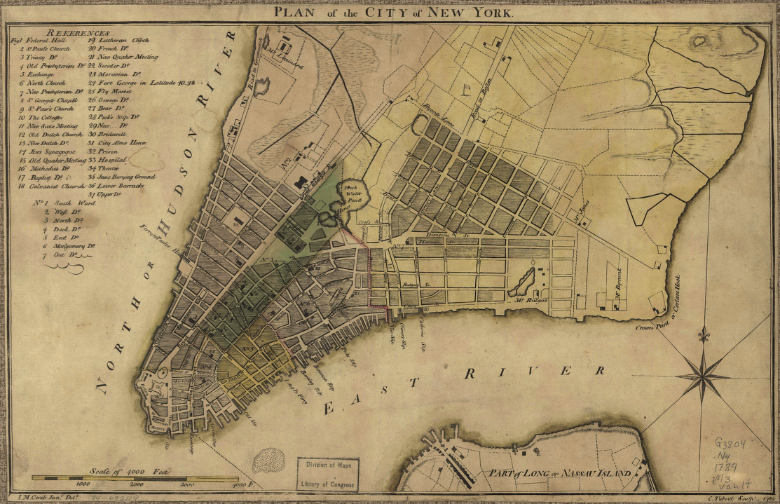
McComb, 1789
Nicholas Street was the former name of Walker St. between Canal St. and West Broadway.
Nicholas Street was the former name of Canal St. between Baxter and Division Sts.
Nieuw Straet was the Dutch name of New Street.
North Street was the former name of East Houston St. between the Bowery and the East River; name was changed in 1833.
Nyack Place was formerly in the rear of No. 31 Bethune St.
Ogden Street was the former name of Perry St.
Old Street was former name of Mott St. between Park Row and Park St.
Old Kiln Road, see Southampton Road.
Old Windmill Lane, see Windmill Lane.
Oliver Street was the former name of Spring St. between the Bowery and Broadway.
Orange Street was the former name of Baxter St. between Park Row and Grand St.
Orange Street was the former name of Cliff St.
Orchard Street was the former name of Broome St. west of Broadway.
Otters Alley formerly ran from Thompson to Sullivan Sts. between Broome and Grand Sts.
Oyster Pasty Alley was the former name of Exchange Alley, was also known as Tin Pot Alley.
Pacific Place was formerly in the rear of No. 133 West 39th St.
Park Street was the former name of Park Row between Ann and Beekman Sts.
Passage Place was the former name of Peck Slip.
Partition Street was the former name of Fulton St. between Broadway to the Hudson River; east of Broadway this street was called Fair St.

Patchin Place
Patchin Place was an alley in the rear of No. 111 West 10th St.
Petticoat Lane was the former name of Marketfield St.; it was known by this name in 1791.
Penn Street was the former name of Pell St.
Petersfield Street was a country road on the Stuyvesant Farm; it started about the present 4th Ave. between 11th and 12th Sts., crossing 3rd Ave. between 12th and 13th Sts., 2nd Ave. between 13th and 14th Sts., 1st Ave. at 15th St., and ended in the center of the block bounded by 1st Ave., Ave. A, 15th and 16th Sts.
Pitt Street was the former name of Elm St. (now Lafayette St.) between Hester and Spring St.; known by this name in 1797.
Prince Street was the former name of Rose St.; known by this name in 1766.
Princess Street was the former name of Beaver St. between William and Wall Sts. During the time of the Dutch it was known as Prinsen Straet.
Prospect Street was the former name of Thompson St.
Provost Street was the former name of Franklin St.; known by this name in 1797; known as Sugar Loaf St. in 1807; name changed to Franklin St. in 1833.
Pump Street was the former name of Canal St. It was known by this name in 1797.
Pye Womans Lane, Pie Womans Lane, was the former name of Nassau St. between Wall St. and Maiden Lane.
Quay Street was the former name of Water St. between Whitehall St. and Coenties Slip.
Queen Street was the former name of Pearl St. between Wall St. and Park Row. This street was known by various names at different periods; known in 1657 as Pearl Street; and in part Hoogh Straet and the Waal; in 1691 as Dock St.; and Great Queen St.; in 1728 as Queen St., and since 1797 as Pearl St.
Queene Street was the former name of Cedar St. between William and West Sts.
Queene Street was the former name of Pine St.; was known by this name in 1691; known as King St. in 1728; name changed to Pine St. in 1794.
Quick Street was the former name of East Broadway.
Raison Street, see Reason St.
Randall Place was the former name of West 9th St. between Broadway and University Pl.
Reason Street was the former name of Barrow St. between Bleecker and Bedford Sts.; name changed in 1828.
Renwick Street was the former name of Baxter St. between Canal and Grand Sts.
Rhinelander Alley formerly ran from Greenwich to Washington Sts. between Beach and Hubert Sts.
Rhinelander Lane was a country road which ran from the Hell Gate Ferry Road at the present 2nd Ave. between 86th and 87th St. northeasterly to the south side of 90th St. between 1st Ave. and Ave. A.
Rider Street, Ridder Street, was the former name of Ryder’s Alley.

Riker Estate at 75th Street
Riker’s Lane was a country road which ran from the Eastern Post Road, about the present 3rd Ave. and 76th St. and ran southeasterly, ending at the East River between 74th and 75th Sts.
Rivington Place was formerly in the rear of No. 316 Rivington St.
Roosevelt Lane was a country road which ran from the Old Harlem Road, about the present Lexington Ave. between 116th and 117th Sts., southeasterly, crossing 3rd Ave. at 115th St., 2nd Ave. at 112th St., then northwesterly to a point in the middle of the block bounded by 1st and 2nd Aves., 114th and 115th Sts., then southeasterly to the Harlem River between 110th and 111th Sts.
Rotten Row, Rough Street, Ruff Street, were the former names of Henry St.
Roy Road, FitzRoy Road, was a country road which ran north from Greenwich Village; it started at the Southampton Road about the present 14th St. between 7th and 8th Aves., and ran northwesterly, crossing 8th Ave. at 22nd St., then north, parallel with and a little west of 8th Ave. and ending at a cross road about the present 42nd St. midway between 8th and 9th Aves. 9th Ave. was closed from 23rd to 42nd Sts. on Oct. 26, 1832.
Robinson Street was the former name of Park Place.
Rosylyn Place was the former name of Greene St. between West 3rd and West 4th Sts.
Rudder Street was the former name of Ryder’s Alley.
Russell Place was the former name of Greenwich Avenue between Charles and Perry Sts.

Rutger’s Mansion
Rutger’s Hill was the former name of Gold St. between Maiden Lane and John St.
Rutger’s Place was the former name of Monroe St. between Clinton and Jefferson Sts.
Rutger’s Street was the former name of Oak St.; known by this name in 1755.
Ryndert Street, Rindert Street, was the former name of Center St. between Canal and Broome St.; known in 1797 as Potters Hill; known in 1807 as Collect St.; known in 1817 as Ryndert St.
Sackett Street was the former name of Cherry St.
St. Clamment’s Place was the former name of Macdougal St. between Houston and Bleecker Sts.
St. David Street was one of the former names of Bleecker St.
St. Hevins Street was the former name of Broome St. between Broadway and Hudson St.; was known in 1755 as St. Hevins St.; known in 1766 as Bullock St.; known in 1797 in part as Bullock St. and in part as William St., and in part as Orchard St.; known since 1807 as Broome St.
St. Johns Street was the former name of John St.
St. Marks Place was the former name of East 8th St.
St. Nicholas Street was the former name of Walker St. between Canal St. and West Broadway.
St. Nicholas Street was the former name of Canal St. between Walker St. and the Bowery.
St. Peters Place was the former name of Church St. between Vesey and Barclay St.
Schaape Waytie (The Sheep Pasture) was the Dutch name of Broad St. between Beaver and Wall Sts.
Scott Street was the former name of West 12th St. between Greenwich Ave. and Hudson St.: was also known as Troy St. and Abingdon Place.
Scott’s Alley formerly ran south from No. 71 Franklin St. to White St.
Second Street was the former name of Greene St.
Second Street was the former name of Forsythe St.
Seventh Street was the former name of Macdougal St.
Seventh Street Place was a short alley, seven houses long, in the rear of No. 185 Seventh St.

Shinbone Alley, Francis H. Smith
Shinbone Alley was the former name of Washington Mews: was also known as Washington Alley.
Sixth Street was the former name of Sullivan St.
Sixth Street was the former name of Waverly Place, between Broadway and Macdougal St.
Sixth Street was the former name of Ludlow St. It was known by this name in 1797.
Skinner Road was the former name of Christopher St.
Skinner Street was the former name of Cliff St. between Ferry and Hague Sts.; known by this name in 1755; known since 1791 as Cliff St.
Slaughter House Lane, Slaughter House Street, Sloat Lane, were the former names of Beaver St. between William and Pearl Sts.; name changed to Beaver St. Dec. 25, 1825.
Slyck Steegh (“Dirty Lane”) was the Dutch name of a lane which was afterwards widened and is now South William St. In 1657 known as Slyck Steegh; in 1674, Mill Street Lane; in 1691, Mill Lane.
Smell Street Lane was the former name of Broad St. between Exchange Place and Wall St.
Smith Court was a short alley which formerly ran from Congress St.
Smith Street, Smee Straet, Smeedes Straet, Smit Street, were the former names of William St. between Wall and Pearl Sts.
Smith Street was the former name of Cedar St. between William and West Sts.; known in 1691 as Smith St.; known in 1728 as Little Queen St.; known since 1794 as Cedar St.
Smith Street was the former name of East Broadway.
Smith Street Lane was the former name of Beaver St. between William and Broad Sts.
Smith Street Valley, Smith’s Vail, Smith’s Valley, Smith’s Vly, were the former names of Pearl St. between Wall St. and Peck Slip.
Southampton Road, Great Kiln Road, was the principal road leading north from Greenwich Village. It started at Gansevoort St., this street being part of the original road; from the present easterly end of Gansevoort St. it ran northeasterly, crossing 8th Ave. at 14th St., 7th Ave. between 15th and 16th Sts.. 6th Ave. at 17th St., then running northerly, just east of 6th Ave., and ending at Love Lane, about the present 21st St. a little east of 6th Ave.
South Fifth Avenue was the former name of West Broadway between Canal St. and Washington Sq.
Spencer Place was the former name of West 4th St. between Christopher and West 10th Sts.
Spingler Place was the former name of East 15th St. between Broadway and 5th Ave.
Stadt Huy Lane was the Dutch name of Coenties Alley.
Stanton Place was an alley formerly in the rear of No. 6 Stanton St.
Stewart Street formerly ran from Broadway between 30th and 31st Sts., southwesterly to a point in the block bounded by 6th Ave. and 7th Ave., 28th and 29th Sts.
Stillwell’s Lane was a country road which started at the Bloomingdale Road (the present Broadway) and 87th St. and ran easterly; about 150 feet east of Amsterdam Ave. it turned southerly, turning again easterly between 85th and 86th Sts., and ended in the present Central Park on a line with 7th Ave. and 86th St.
Stone Street was the former name of Pearl St.
Stone Street was the former name of Thames St.
Stone Bridge Street was one of the former names of Broadway.

The Residence of Jacob Leisler on the Strand, 1679
Strand, The, was the name of the north side of Pearl St. between Broad St. and Old Slip; was known by this name when Pearl St. was fronting on the East River.
Striker’s Lane, see Hopper’s Lane.
Stueben Street formerly ran from the Eastern Post Road and 41st St. northwesterly to the Albany Road between 43rd and 44th Sts.
Stuyvesant Place was the former name of 2nd Ave. between 7th and 10th Sts.
Stuyvesant Street. The present street of this name, which now ends at 2nd Ave., formerly continued northeasterly, crossing 1st Ave. between 12th and 13th Sts., Ave. A at 14th St., and ended at the East River about the present 15th St. between Avenues A and B.
Sugar Loaf Street was the former name of Franklin St. between Broadway and Baxter St.; was known by this name in 1807.
Suice Straet was the Dutch name of William St. between Hanover Square and William Sts.
Susan Street was a country road in the Kip’s Bay Farm. It ran from the Eastern Post Road, the present Lexington Ave., between 38th and 39th Sts. southeasterly, crossing 38th St. between 2nd and 3rd Aves., and ending at the East River between 37th and 38th Sts.
Third Street was the former name of Wooster St.
Third Street was the former name of Eldridge St.
Thomas Street was the former name of Duane St. between Elm and Rose Sts.
Thomas Street was the former name of Pearl St. between Broadway and Park Row.
Thomas Street was the former name of William St. between Frankfort and Pearl Sts.
Thomas Street was the former name of Thames St.
Thompson’s Court was an alley which formerly ran from No. 363 Rivington St.
Tienhoven Street was the former name of Liberty St.; known in 1691 as Crown St.; name changed to Liberty St. in 1794.
Tienhoven Street was the former name of Pine St.
Tin Pot Alley was the former name of Exchange Alley; was also known as Oyster Pasty Alley.
Tompkins Place was the former name of East 10th St. between Greenwich Ave. and the Hudson River.
Torbet Street was a country road on the Rutger’s Farm; it ran from Henry to Madison Sts. between Catherine and Market Sts.
Troy Street was the former name of West 12th St. between Greenwich Ave. and the Hudson River.
Tulip Street was a country road on the Glass House Farm. It ran from 34th St. between 10th and 11th Aves, southerly to a point in the block bounded by 9th and 10th Aves., between 32nd and 33rd Sts.
Turin Lane was a country road which ran from the Bloomingdale Road (Broadway) between 93rd and 94th Sts. and ran easterly, ending at the Eastern Post Road, about the present 96th St.
Tuyn Straet was the name given to the present Exchange Place by the Dutch.
Tyron Row formerly ran from Center St. to Park Row on the ground now occupied by the south end of the Municipal Building.
Union Court was formerly on University Place between 12th and 13th Sts.
Union Place was the former name of the west side of 4th Ave. and the east side of Broadway between 14th and 17th Sts.
Union Road formerly ran from the Skinner Road, in the block bounded by 5th and 6th Aves., 11th and 12th Sts., northwesterly to the Southampton Road at 7th Ave. and 15th St.Union Street was the former name of Greene St.
Van Bruggen Street was the former name of Pine St.
Van Nest Place was the former name of Charles St. between 4th and Bleecker Sts.
Varrick Place was the former name of Sullivan St. between Houston and Bleecker Sts.
Verdant Lane; also called Feitners Lane; was a country road which started at the Bloomingdale Road (Broadway) between 45th and 46th Sts., and ran northwesterly crossing 8th Ave. between 46th and 47th Sts., 9th Ave. between 47th and 48th Sts., 10th Ave. between 48th and 49th Sts., 11th Ave. between 49th and 50th Sts., and ended at the Hudson River between 49th and 50th Sts.
Village Street was the former name of West Houston St. between Macdougal St. and the East River.
Walker Street was the former name of Canal St. between Baxter and Ludlow Sts.
Warren Place was the former name of Charles St. between Greenwich Ave. and Waverly Place.
Warren Road was a country road in Greenwich Village which ran from the Southampton Road to Love Lane, from the present 16th to 21st Sts. between 6th and 7th Aves.
Warren Street was the former name of Clinton St.
Walnut Street was the former name of Jackson St.
Washington Alley was the former name of Washington Mews.
Washington Street was the former name of Jefferson St.
Weaver Street was the former name of Vesey St.
Wendel Street was the former name of Oak St.
Wesley Place was the former name of Mulberry St. between Houston and Bleecker Sts.
West Court was formerly in the rear of No. 66 West 22nd St.
West Avenue, see Albany Road.
West Broadway Place was the former name of West Broadway between Canal and Grand Sts.
White Place was formerly in the rear of No. 134 West 18th St.
White Street was the former name of Ann St.
William Street was the former name of Broome St. between the Bowery and Sullivan St.; was known by this name in 1797.
William Street was the former name of West 4th St. between Christopher and West 13th Sts.; known by this name in 1807.
William Street was the former name of Madison St. between Catherine and Montgomery Sts.
Willow Street was the former name of Macdougal St.
Winckel Straet was a short street running north from Bridge St. just east of Whitehall St. It was closed in 1680.
Windmill Lane was a former name of Cortlandt St. Known by this name in 1728.
Winne (or Wynne) Street was the former name of Mott St. between Pell and Bleecker Sts. Known by this name in 1755.
Winthrop Place was the former name of Greene St. between Waverly Place and West 8th St.
Wooster Street was the former name of West Houston St., between Broadway and Macdougal St.
Wooster Street was the former name of University Pl. between Waverly Pl. and West 14th St.
Wynkoop Street was the former name of Bridge St.
